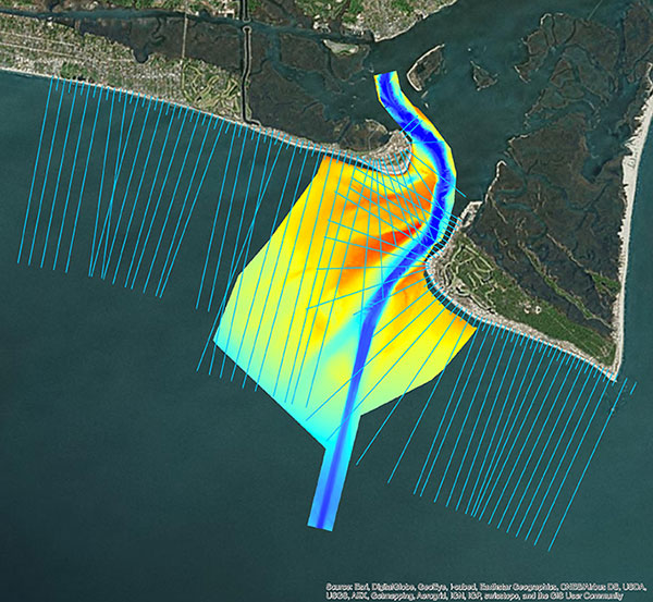
NV5 Geospatial acquires Geodynamics to expand marine survey offerings
May 18, 2021
Following its March 29 acquisition of Geodynamics LLC, NV5 Geospatial has built a comprehensive suite of solutions for […]
Read More
Following its March 29 acquisition of Geodynamics LLC, NV5 Geospatial has built a comprehensive suite of solutions for […]

The original Tappan Zee Bridge, spanning the Hudson River between Tarrytown and Nyack in the state of New […]
Bluesky International will use aircraft-mounted lidar sensors and laser scanners to create a highly detailed 3D map of […]
SPH Engineering has launched a product designed to conduct bathymetric surveys of inland and coastal water. The system […]

Highly cost-effective autonomous marine drone for bathymetric surveys The new Apache3 Marine Drone — 2020 Edition provides a […]

Drones are quickly becoming a staple of the maritime industry. In January, the European Maritime Safety Agency (EMSA) […]

Fugro has been awarded a supply arrangement by the Canadian Hydrographic Service (CHS) to provide vessel-based hydrographic survey services. […]
Fugro has extended its integrated survey services to help improve efficiency in coastal management and enable more informed […]


Follow Us